![]()
![]()

Future flood hazard in the Mekong Delta
Flood hazard analysis is an indispensable input for flood risk assessment. An essential part is the determination of probabilities of occurrence of floods of different magnitudes. However, the underlying assumption of stationarity does not hold for most of the observed discharge time series in general, and in particular not for future climate conditions. This is of particular importance for low lying coastal areas and estuaries like the Mekong Delta, which is one of the most vulnerable areas for climate change impacts world-wide.
Within WISDOM a novel approach for flood hazard mapping considering changes in climate variability was developed. We explicitly take non-stationarity in the discharge time series into consideration and establish a climate-flood link for the estimation of future flood hazard (cf. Linking floods to climate). This approach utilizes the identified correlation of monsoon indexes to flood magnitudes in the Lower Mekong, resp. the correlation in variability of the entities, thereby avoiding the necessity of regional downscaling of GCMs and hydrological modeling with all the inherent uncertainties.
Utilizing the output of 14 GCMs and a multi-objectively calibrated large scale hydraulic model, the flood hazard for the Mekong Delta in 2050 is estimated considering the uncertainty originating from different GCM predictions and hydraulic model calibrations. The uncertainty is visualized by probabilistic flood hazard maps.
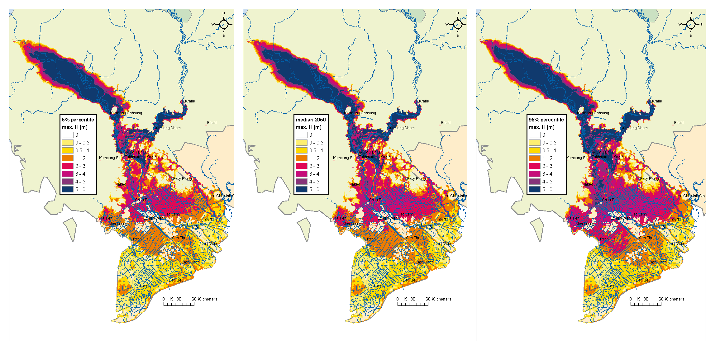
Fig. 2: Probabilistic flood hazard maps for a 100-year flood event for the Mekong Delta in 2050. Uncertainty is visualized by percentile maps (left: 5%, middle: median, right 95%) of simulated inundation depths.
See also:
http://meetingorganizer.copernicus.org/EGU2012/EGU2012-10348.pdf
http://presentations.copernicus.org/EGU2012-10348_presentation.pdf