![]()
![]()

Wetland loss in the Ha Tien Plain
The Ha Tien Plain, located in the north-western part of the Mekong Delta, was once considered to be the last remaining extensive wetland area of seasonally inundated grassland in the Mekong Delta, supporting a high diversity in flora and a rich avifauna. Since the mid-1990s this valuable wetland ecosystem is threatened by the conversion into agriculture, aquaculture and forest plantations.
Since wetlands are often difficult to access and field surveys are time and cost intensive, remote sensing methods that use satellite images, covering large geographic areas at a constant interval, provide optimal means to investigate land cover change over time in a spatially comprehensive manner. In this study two satellite images from the Landsat program, recorded in 1991 and 2009, with a spatial resolution of 30 m, have been used to analyse land cover change in the Ha Tien Plain with a special focus on seasonally inundated grassland. In order to generate explicit land cover maps (figure 1), the two images where classified by a pixel-based approach, using the C5.0 decision tree classifier implemented in TOWPAC (twinned object and pixel based automated classification chain). Subsequent post-classification comparison techniques revealed a decrease of 77 % of the area classified as seasonally inundated grassland in 1991 mainly caused by the expansion of agriculture (paddy fields), water bodies (aquacultural ponds) and forested areas (plantations). Areas influenced by flood water in 1991 where excluded from the analysis. Figure 2 presents a change detection map showing the changes of seasonally inundated grassland between 1991 and 2009.
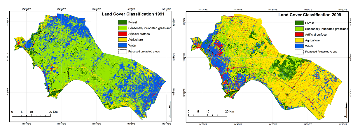
Figure 1: Land cover maps of the Ha Tien Plain derived from Landsat images recorded in 1991 and 2009, respectively (submitted to IJRS)
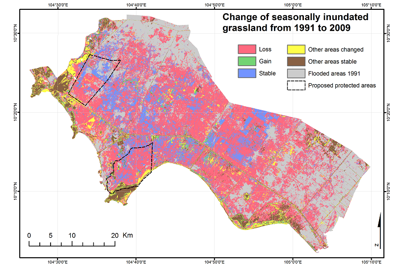
Figure 2: Change of seasonally inundated grassland between 1991 and 2009 (submitted to IJRS)