Hydrodynamic modeling of the Mekong Delta
A 1D hydrodynamic model of the Mekong Delta developed at SIWRR was further improved by collecting more data on dike lines and elevations and an improved representation of the floodplains in the one-dimensional model domain. With the new data it was calibrated against the record flood in 2000 and additionally validated by simulating the flood in 2001. Both calibration and validation runs show a very good agreement with the recorded discharges.
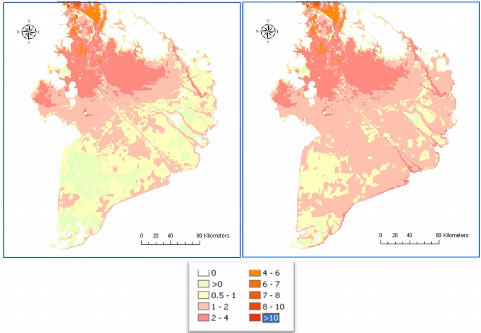
A 1D hydrodynamic model of the Mekong Delta developed at SIWRR was further improved by collecting more data on dike lines and elevations and an improved representation of the floodplains in the one-dimensional model domain. With the new data it was calibrated against the record flood in 2000 and additionally validated by simulating the flood in 2001. Both calibration and validation runs show a very good agreement with the recorded discharges. In a next step the simulated inundation depths in the channels and the innovative representation of the floodplains were interpolated to inundation maps. By this, a spatial representation of the inundation of the whole delta was reached, which has a much larger information content than the point data from the 1D model alone. This information can be presented and processed in GIS and used e.g. for flood risk assessments for the whole delta. In a further step, the calibrated model was used to assess the impacts of projected sea level rises in the area. Being a low lying costal area, the sea level plays an important role on the hydrology and the agro-ecosystem of the delta. Figure 1 shows the inundation of the year 2000 with the current sea level and the inundation simulated with the same discharge but with a raised sea level by 50cm. It can be seen, that a much larger area is prone to inundation in this scenario. This information has to be included in future flood mitigation and management schemes.

Figure 1: Simulated inundation of the Mekong Delta of the flood in 2000 (left) and simulated with the same discharge, but a raised sea level of 50cm (legend in m).


