Hydraulics in the Mekong Delta – Investigation area Tam Nong
The investigation area in Tam Nong has been equipped with a large number of sensors in order to monitor the inundation and sediment transport dynamics. The whole instrumentation scheme encompasses:
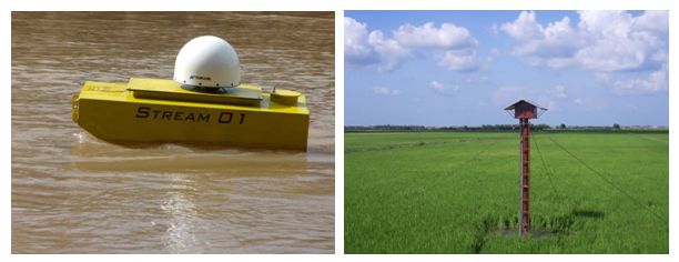
- 2 stationary GPS buoys for the monitoring of water levels in the major rivers
- 7 main survey station with probes for water level, suspended sediment and electric conductivity with autonomous power solar supply
- 14 satellite station for autonomous water level recording

Figure 1: A GPS buoy in action and a main survey station in the floodplain.
The survey stations are installed at channels as well as the floodplains over the whole investigation area and will record the inundation process throughout the complete flood season. These dataset will, for the first time, give a very detailed picture about the inundation and sediment transport dynamics in floodplains in general and in the Mekong Delta specifically. With these data a thorough analysis and calibration of 2D hydrodynamic models will be possible.


