![]()
![]()
Vulnerability Assessment research in Can Tho 2009
Explorative research in Can Tho (one of the three case study areas of the WISDOM project) has produced insights on characteristics of urban and peri-urban vulnerabilities. Through the combination of different methods such as focus group discussions with experts, household interviews and the analysis of secondary (statistical) data, knowledge on vulnerability patterns and governance processes could be gained. Through this, research questions and methodological approaches could be fine-tuned for the next research phases.
Using the example of figure 1 (left), which was taken at a medium tide level at An Lac Ward in Can Tho’s Ninh Kieu district, major vulnerabilities to water-related hazards and climate change can be illustrated. Household interviews and the application of other participatory urban appraisal-methods like, for instance, wealth rankings (see figure 1, right side) revealed that the houses directly along the river – mostly with poor housing conditions – are predominantly inhabited by low-income families. Hence, these households suffer from a multiple burden: First, they are highly exposed to water-related hazards such as floods, water-level rise and river bank erosion. Second, bank erosion forces these households to rebuild, shift or elevate their houses every couple of years (see figure 2, left and right) putting, third, a distinctive financial pressure on the respective families who have only very limited financial resources anyway. The interviews further revealed that distinct discrepancies exist between risk perception amongst the citizens of Can Tho with respect to future hazards in the context of climate change (particularly water level rise and the increase in storm and Typhoon activity) and the scientific evidence and forecasts on the other side. Of particular importance in this context seems to be the fact that Can Tho is located approximately 70 km inland and ocean-related hazards including sea level rise and Typhoons have so far only had a limited impact on the city. Hence, also the perceived risk regarding those hazards is very low – which does not account for the fact that the situation will most likely change fundamentally due to climate change.
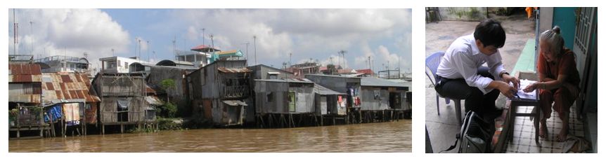
Figure 1 - left side: low quality housing along the Can Tho River (source: picture Matthias Garschagen), right side: conduction of household interview (source: picture Matthias Garschagen).
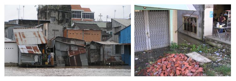
Figure 2 - left side: collapsed house as a result of river bank erosion (source: picture Matthias Garschagen), right side: elevated house (right) vs. un-elevated house (left) (source: picture Matthias Garschagen).
Out of the explorative household interviews a questionnaire (c.f. figure 1) has been developed and pre-tested in two case study wards in Ninh Kieu district, Can Tho. The pre-test gave ample insights with respect to response effects, timing, training of translators etc. This knowledge is an essential prerequisite for the fine-tuning of the questionnaire and for the planning of the main household survey which will be conducted in all three case study sites of the vulnerability assessment in 2009.
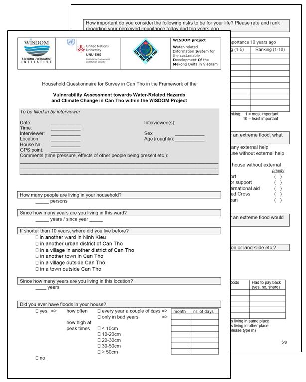
Figure 3: questionnaire for household survey (source: Matthias Garschagen).
Next to the household interviews, expert interviews and focus group discussions have been conducted with official planning and flood control institutions at the district and ward level (figures 4). The three main foci of these interviews and discussions were on the risk perception of the respective institutions, on the responsibilities and competencies of different institutions and on the policies with respect to climate change adaptation. First analysis of the results suggests that the level of sophistication and implementation of responsibilities and policies vary with respect to different hazards. While many explicit rules and procedures can be observed with respect to rather familiar hazards such as floods, impacts of, for instance, climate change are only started to be analyzed in detail and factored into policy making and planning processes. Besides, the need for a stronger integration of different planning institutions and processes was mentioned by many official stakeholders. Particularly with respect to the possible overlapping of creeping and sudden-onset hazards that are managed by separate institutions this integration was mentioned to be of high importance. A more detailed analysis of integration potentials regarding specific stakeholders and planning instruments will be conducted in the next research phase.
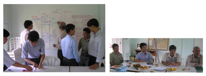
Figure 4: focus group discussion with decision makers from official institutions in Can Tho (source: pictures Matthias Garschagen).
As mentioned above, a third branch of research within the vulnerability assessment is constituted by the analysis of secondary data and the visualisation targeting for the implementation into the information system. Figures 5 are given here as examples.
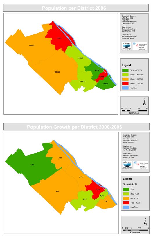
Figures 5: spatial analysis and visualisation of secondary data (source: Matthias Garschagen).