![]()
![]()

Seasonal Inundation of the Mekong Delta derived from TerraSAR-X Satellite Data
The title of this map is “Vietnam – Mekong Delta – Plain of reeds – Seasonal inundation”.
It depicts the inundated areas during the rainy and the dry season derived from TerraSAR-X satellite. The legend on the right side of the map describes important map attributes, such as the map elements, the data sources, and additional map information. As the data source of this map, TerraSAR-X Stripmap mode images from October, 20th 2007 and January, 5th 2008, as well as a Landsat satellite image from 1990 as map background were employed.
Method: The flooded areas have been derived from the TerraSAR-X images using the FLOODMASK software (©DLR). The algorithm basically separates the images in land and water portions and further analyses the existence of islands and small lakes. The Terra SAR-X satellite delivers X-Band SAR data in various modes. The Strip-Map mode enables images at 3m resolution at 30 km swath.
As additional information, the borders of the Tam Nong district test sites of the WISDOM project (displayed in red) as well as other administrative borders such as communal boundaries are included in the map.
This map was created by DLR for the WISDOM project. For more information please contact Dr. Claudia Kuenzer (claudia.kuenzer@dlr.de), project coordinator on the German side. – June 2008
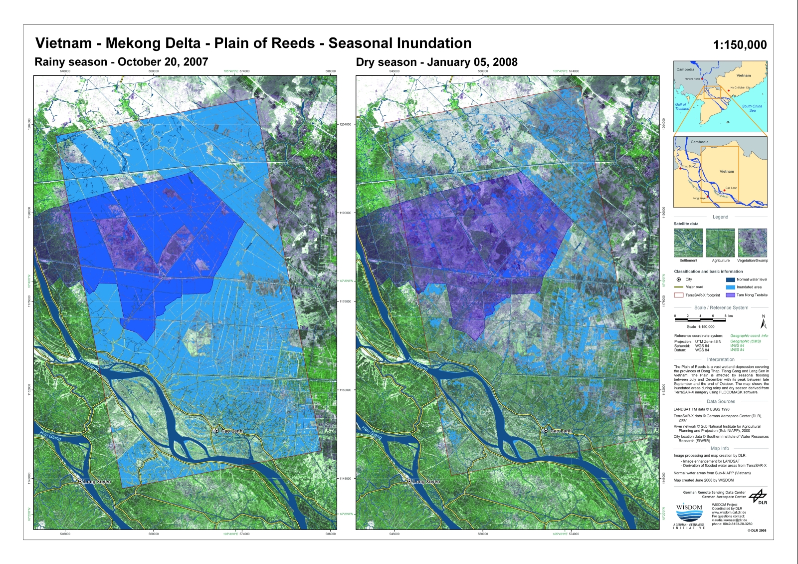
Figure 1 - Seasonal Inundation of the Mekong Delta derived from TerraSAR-X Satellite Data