![]()
![]()

Large scale monitoring of floodplain sedimentation
Floodplain sedimentation plays an important role for the agro-ecosystem in the Mekong Delta. In phase 1 of WISDOM the sediment dynamics and processes were studies in detail on a selected part of the floodplain. In this second phase, the spatial variability of floodplain sediment deposition is both monitored and simulated. For this purpose an extensive monitoring scheme was implemented for the flood season 2011. It consists of approximately 450 sediment traps distributed over the main inundation areas of the Mekong Delta (Plain of Reeds and Long Xuyen Quadrangle). The monitoring sites were carefully selected in order to cover the different dike systems and distance to the main rivers and channels. Figure 1 shows the selected monitoring sites, were sediment traps were distributed in different floodplain compartments. Within each floodplain compartment several sampling locations were selected to monitor the spatial distribution within a compartment. Each sampling locations consists of 3 sediment traps enabling an uncertainty estimation of the monitored sediment deposition at each location.
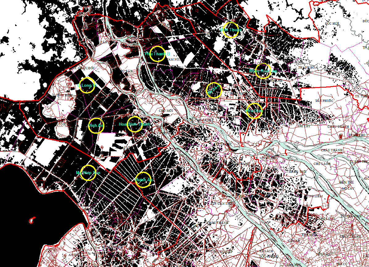
Fig. 1: Monitoring sites for floodplain sedimentation in the northern part of the Mekong Delta.
The sediment masses collected in the traps were analyzed after collection in December 2011. Analyzed parameters were:
1. Physical parameters:
Dry weight of samples Ms;
Particle size distribution
2. Chemical parameters:
pH
Total nitrogen (N)
Total phosphorus (P)
Total Potassium (K)
Fig. 2 shows the results of the analysis for all collected sediment traps.
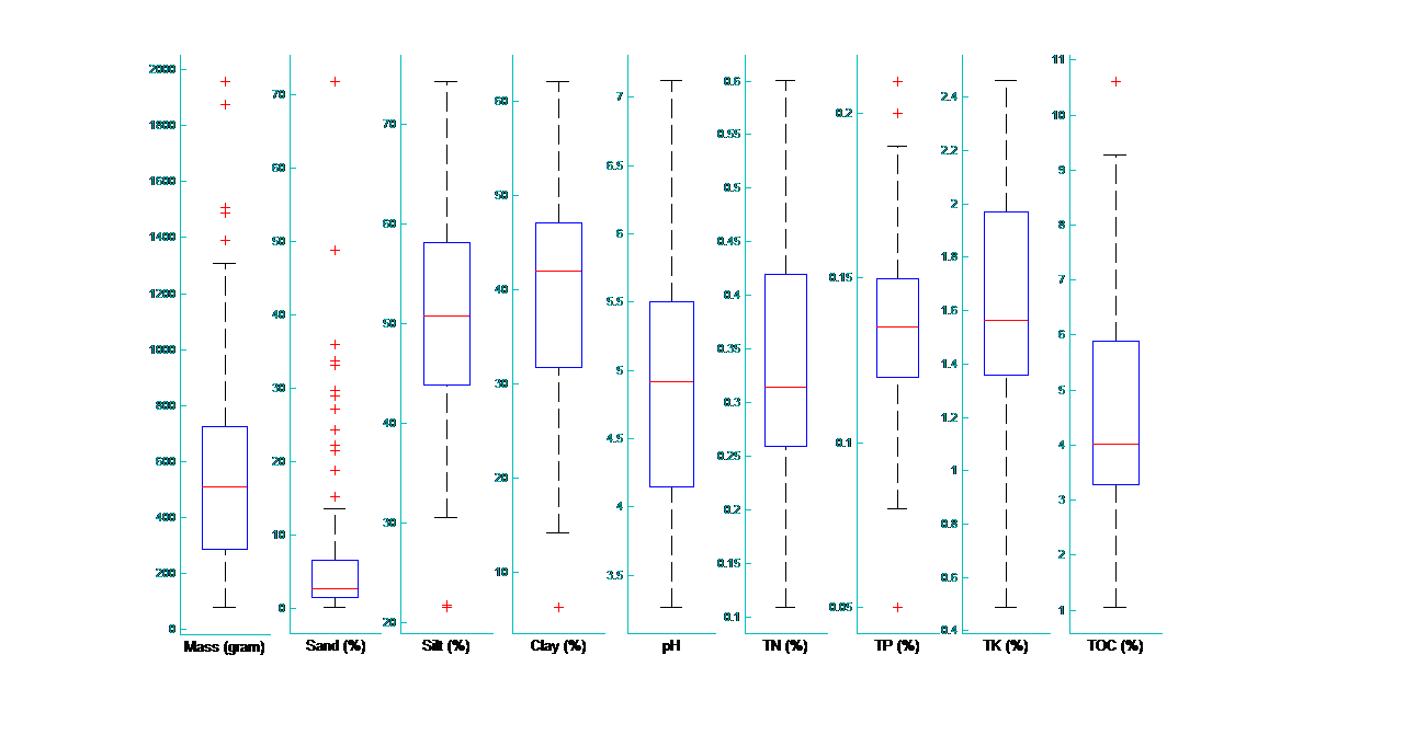
Fig. 2: Box plot of sediment analysis results over all retrieved samples: deposited sediment mass (kg), sediment density (g/cm3), sediment grain size classification of Sand, Silt and Clay, potential Hydrogen (pH), Total Nitrogen (TN), Total Phosphorus (TP), Total Potassium (TP) and Total Organic Carbon (TOC).
The collected data are further analyzed regarding their uncertainty and interpreted regarding spatial distribution within the Delta. In a following step the data will be used to calibrate a sediment transport model for the whole Mekong Delta.