![]()
![]()

Flood monitoring using MODIS 250m
A series of tropical storms and heavy monsoon rains combined to make 2011 the worst flood season on the lower Mekong River in the last decade. The following images compare seasonal flooding along the Mekong River on October 16, October 23, and November 1, 2011.
Acquired by the Moderate Resolution Imaging Spectroradiometer (MODIS) on the Aqua and Terra Satellites, the images were processed using the Modular Inversion & Processing System (MIP) by EOMAP.
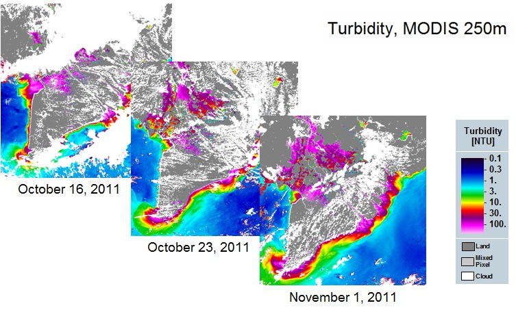
Figure 1 - Turbidity [NTU] derived from MODIS
Integration of high resolution satellite images
For the monitoring of water constituents in the Mekong Delta, high resolution images were used. Figure 2 shows Total Suspended Matter (TSM) - corresponding "Turbidity"- based on the SPOT5 image acquired on 2009-02-17, 03:05:33 (UTC) with 10m resolution. Two subsets with more detailed information displaying sediment dynamics in the Mekong River Estuary are shown on the right.
Method: For data and product processing the Modular Inversion and Processing System (MIP) is used. It is a processing and development tool designed for the retrieval of hydrobiological parameters from multi- and hyper-spectral remote sensing data. The architecture of the program consists of general and transferable algorithms based on physical inversion schemes that derive biophysical parameters from the measured radiance signal at the sensor. Inverted parameters include the variable constituents of the atmosphere, the concentration of water constituents, and the reflectance characteristics of substrates in shallow waters.
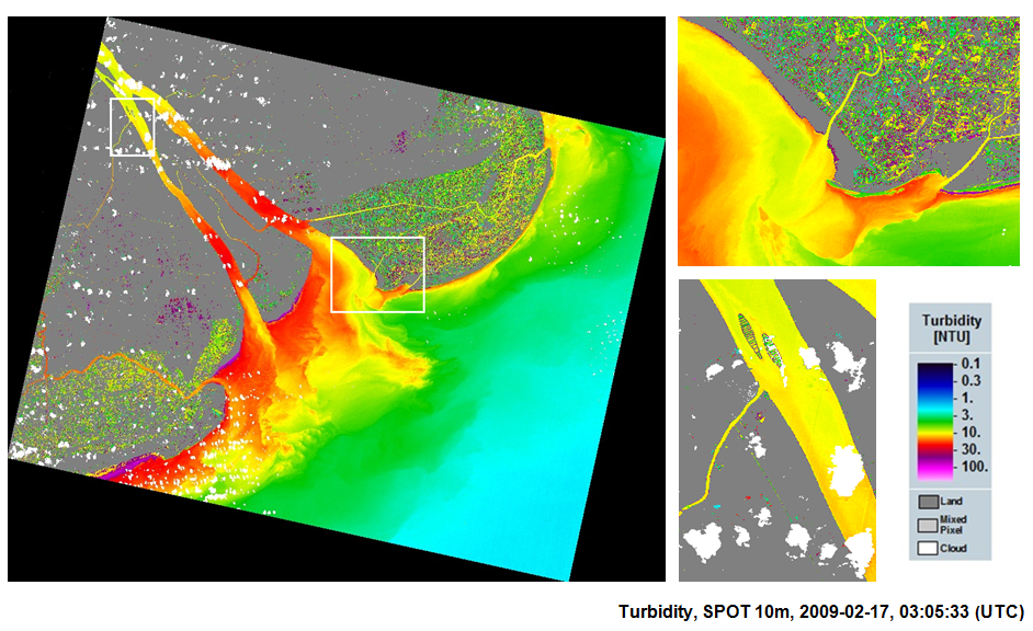
Figure 2 - Turbidity [NTU] derived from SPOT5