![]()
![]()
Study sites
By Toan Pham Van, Loan Vo Phuong Hong, Zita Sebesvari, Fabrice Renaud
Within the three WISDOM project areas two study sites have been identified where pesticide monitoring and modelling are conducted (Fig 1). One study site is located in Ba Lang ward, Cai Rang District, Can Tho Province and one in An Long commune, Tam Nong District, Dong Thap Province. The two study sites account for different land use, water management and pesticide uses.
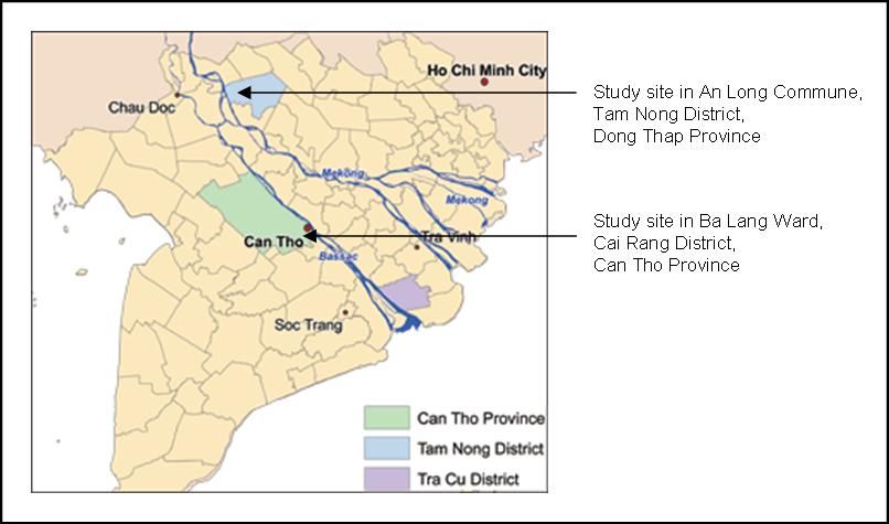
Figure 1: Study sites. Map: DLR, adapted
Study site in Ba Lang ward (Cai Rang District, Can Tho Province)
Ba Lang ward is located in the suburban area of Can Tho City and is irrigated by the Can Tho River and its branches. The area is important as it provides Can Tho – the biggest city in the Mekong Delta, with many fruits and vegetables.
The study site is an area of approximately 6 hectares with defined boundaries and mixed land use and is located along both sides of the Cai Doi canal which is a branch of Ba Lang River. Intensive contact with local farmers, recording of pesticide spraying events and land use changes allow for a better understanding of pesticide management and are important information for both monitoring and modelling activities.
Thirteen farmers farm in the area. In June 2008 ca. 55% of the study was cultivated with paddy rice while the remaining ca. 45 % was nearly evenly distributed among fruits and vegetables. The fields draw water for irrigation and discharge from/to the Cai Doi canal via plastic pipes or open natural gates and are separated from each other by small levees.
For pesticide monitoring 15 samples (13 field outflows, upstream and downstream boundaries of the study site in the canal) are taken in the study area every three weeks and analysed for 12 pesticides. Beside pesticide residue concentration the pH, temperature, electrical conductivity, dissolved oxygen, water velocity and water level are determined during every sampling event. Additionally to the regular monitoring activities spaying related sampling campaigns are taking place.
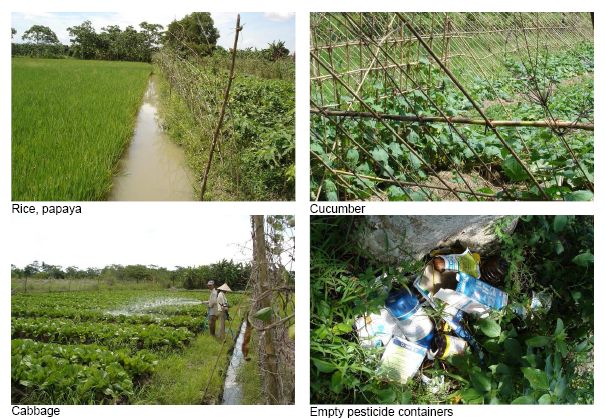
Figure 2: Pictures by Zita Sebesvari
Study site in An Long Commune
The study site is located in the north-eastern part of An Long commune with a total area of approx. 8.5 hectares. Paddy rice is the only crop cultivated in the study area (two crops per year). The first crop is cultivated from November/December to March (winter-spring crop) and the second crop from April/May to July/August (summer-autumn crop). The area is affected by high flood during the wet season. Flooding usually starts in August/September and lasts until November.
Similar to Ba Lang ward, an area with 13 rice fields and defined boundaries was selected for pesticide monitoring and modelling. The fields drain into an irrigation channel which is discharging into the An Long 2 canal. The fields are separated from each other by small levees. 14 water samples (12 field outflows, upstream and downstream boundaries of the irrigation canal) are taken in the study area every six weeks and analysed for 12 pesticides. Beside pesticide residue concentration the pH, temperature, electrical conductivity, dissolved oxygen, water velocity and water level are determined at every sampling event.
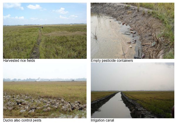
Figure 3: Pictures by Zita Sebesvari